×
模态框(Modal)标题
在这里添加一些文本
Close
Close
Submit
Cancel
Confirm
×
模态框(Modal)标题
×
Toggle navigation
Home
About Journal
Journal Online
Just Accepted
Current Issue
Archive
Most Read
Most Download
Most Cited
E-mail Alert
Contact Us
中文
Figure/Table detail
A study on the time of bridge sinking into the sea at Qiaotou village in Dongzhai port,northern Hainan Province and slow sinking rate and mechanism of Dongzhai port after Qiongzhou earthquake
Qihao XU
J Palaeogeogr
, 2024, 26(
3
): 725-752. DOI:
10.7605/gdlxb.2024.02.024
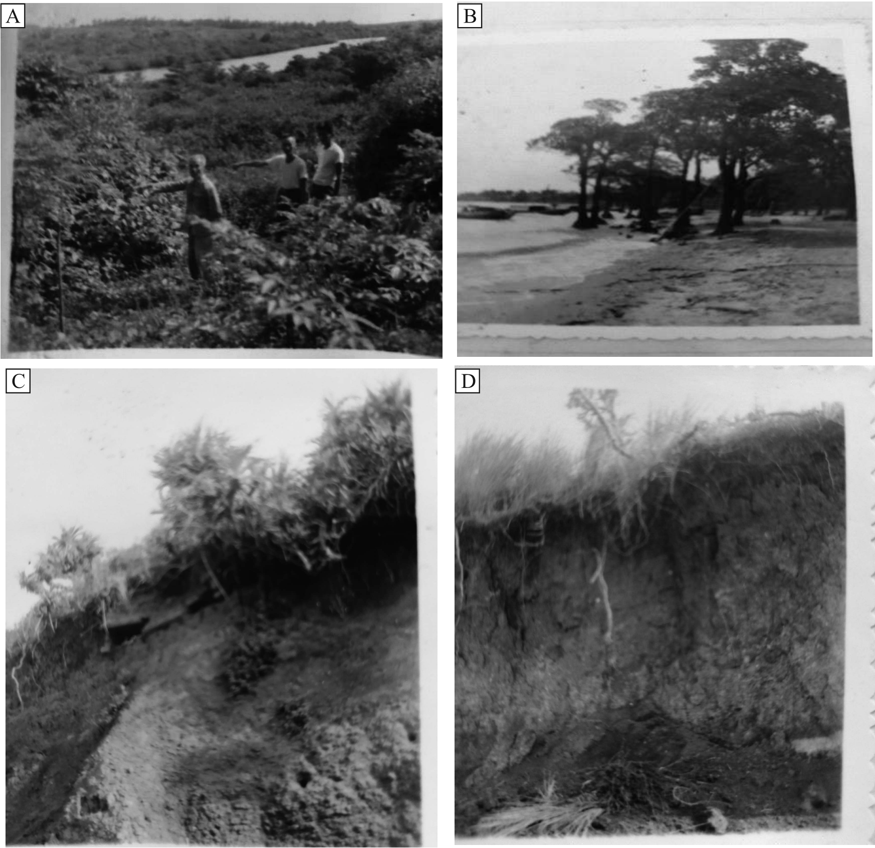
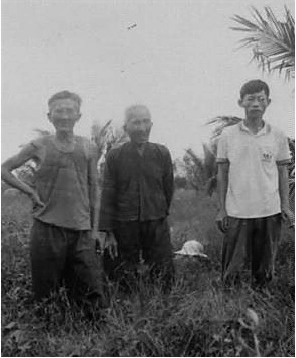
Fig.9
Fisherman and coastal residents of Dongzhai port measured the magnitude of sea level rise over past few decades based on experience at seaside scene
Other figure/table from this article
Table 1
Earthquake examples of coseismic subsidence and subsequent sustained slow sinking rates and theirs formation environment
Fig.1
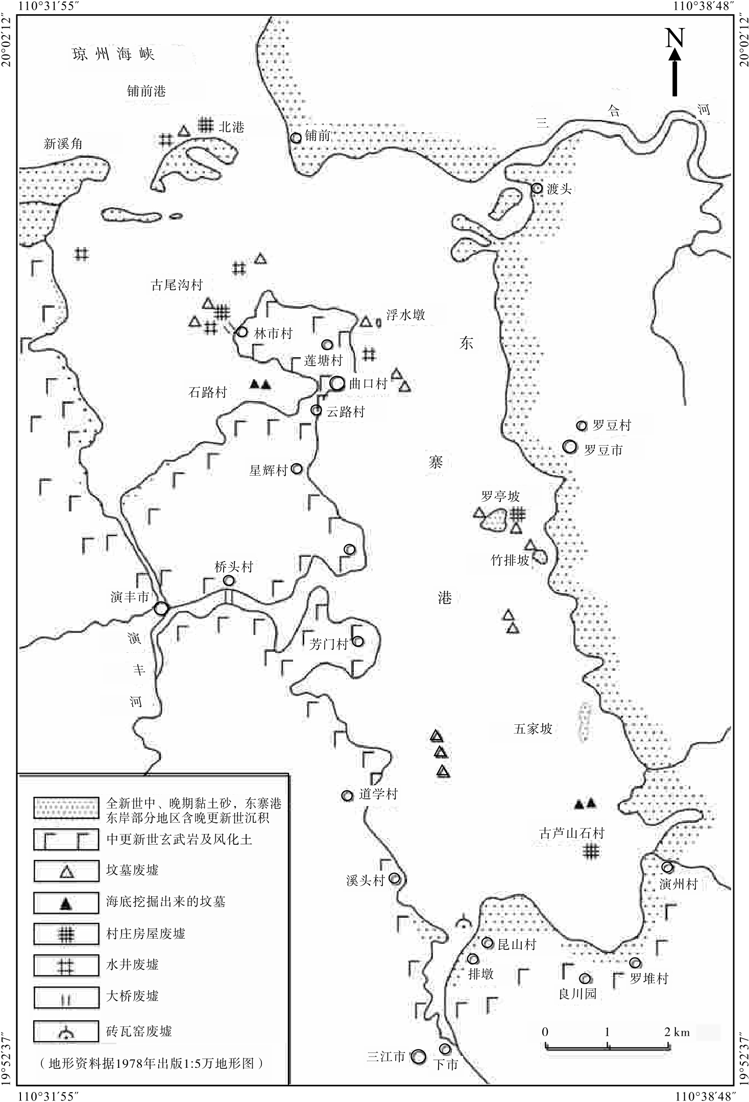
Distribution of some ruins formed by land falling into the sea on the shoal after low tide at Dongzhai port,Nouthern Hainan Province
Fig.2
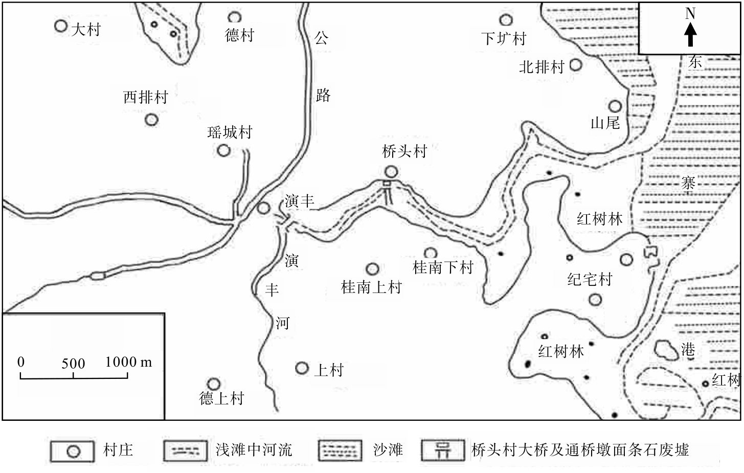
Location of ruins of bridge and strip stone pavement at north head of bridge in Qiaotou village of Yanfeng district of Qionshan county and around landform
Fig.3
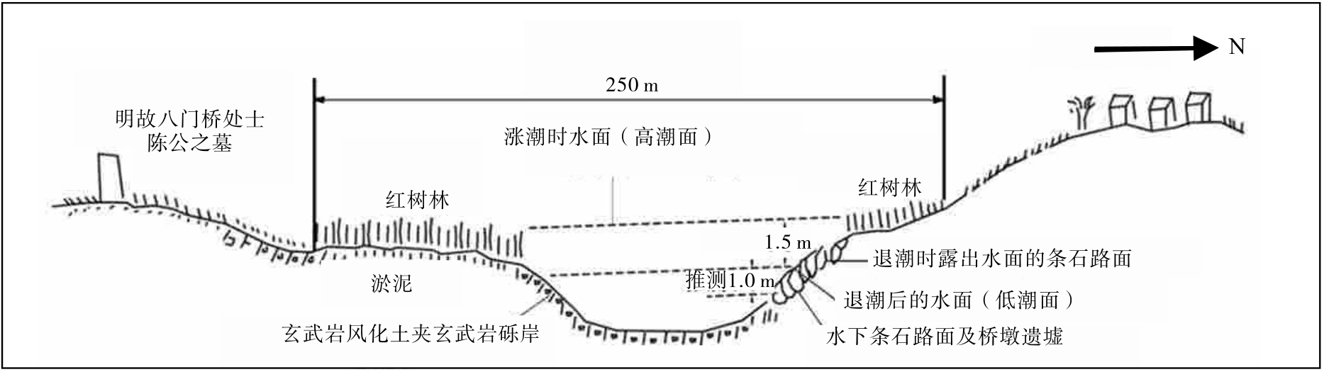
Sketch map showing ruins of bridge and strip stone pavement at north head of the bridge that sank into the sea and their surroundings in Qiaotou village of Yanfeng district of Qiongshan county,Hainan Province
Fig.4
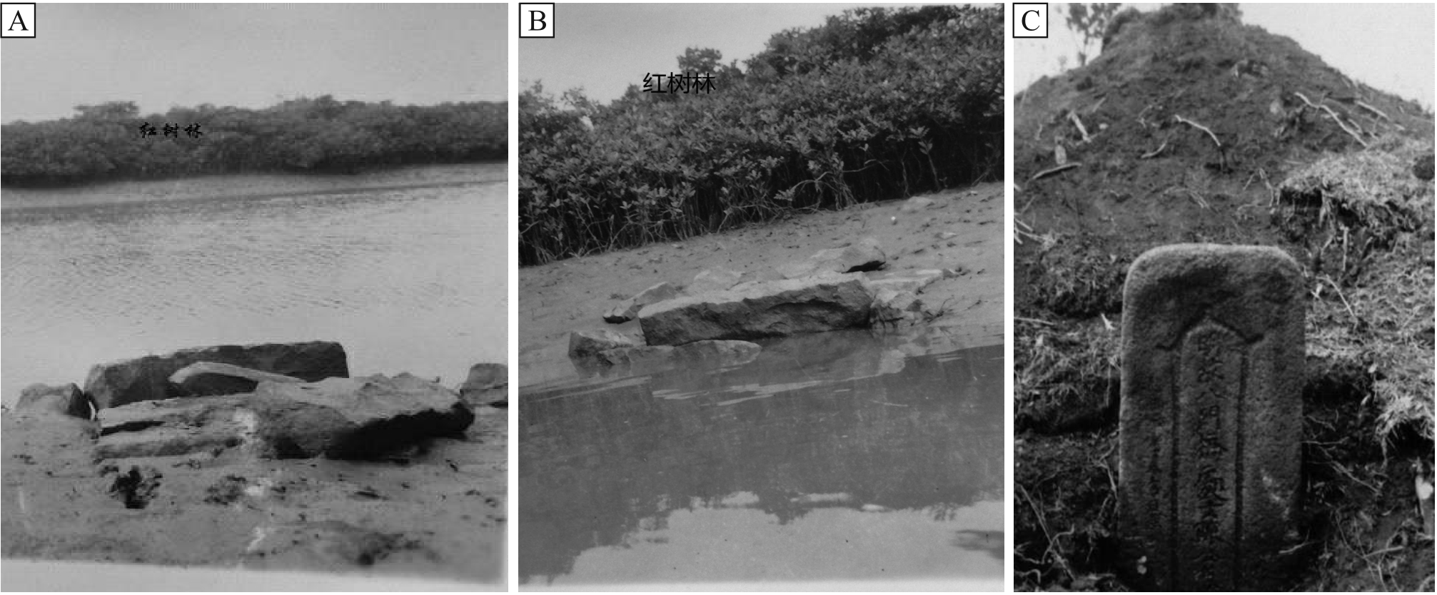
Ruins of strip stone pavement at north head of bridge in Qiaotou village and tomb of Chen Tingluan,ancestor of Ming Dynasty of Qiaotou village people
Table 2
Tide difference of ports in northern Hainan Province
Table 3
Textual criticism for time of Chen Tingluan died of first generation of Qiaotou village
Fig.5
Sea level has risen,and coast of Dongzhai port has been eroded
Fig.6
Sea is approaching villages,and dock is destroyed
Fig.7
Bridge damage and well water becomes salty or abandoned or collapse to seabed or be buried due to sea level rise
Fig.8
Local villagers identified this as ancient lushanshi village in Dongzhai Port that is slowly sank into sea after earthquake
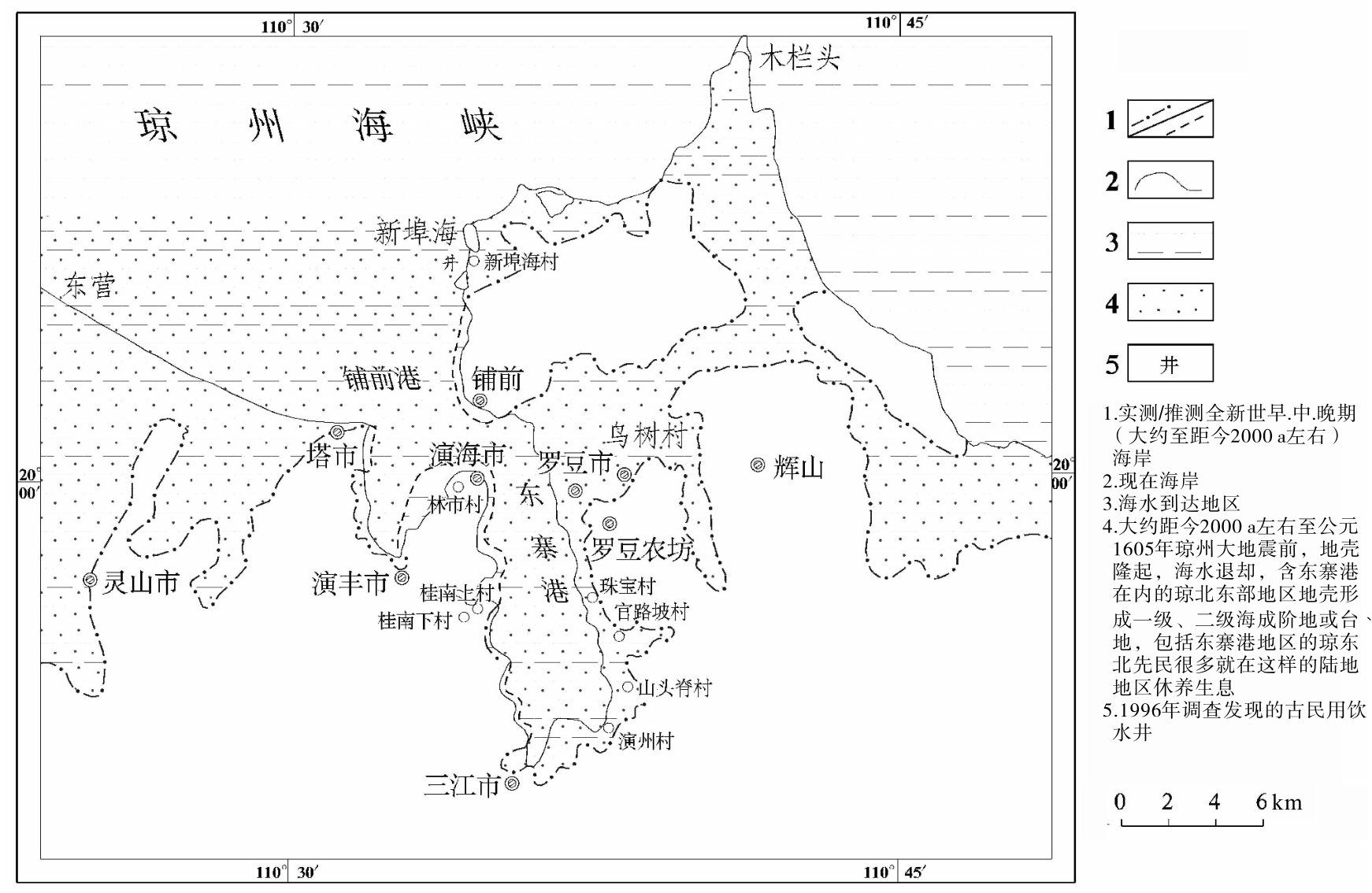
Fig.10
Map of the Holocene marine immersion range and distribution areas of ancestors living before 1605 Qiongzhou earthquake in Dongzhai port and surrounding areas of east part of northern Hainan Province
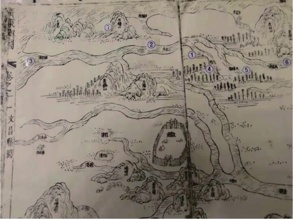
Fig.11
In the 24th year of Kangxi reign of Qing Dynasty(1685),Wenchang County picture of
Guangdong and the Picture
recorded three tributaries of Sanjiangshui river that has Dongzhai river(Dongzhai Port)
②
Fig.12
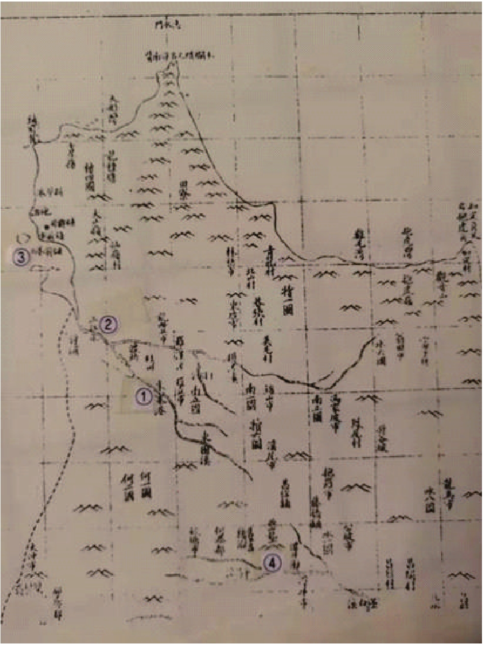
Geographical location map of Dongzhai port that had been one of the tributaries of Sanjiangshui river in northern Wenchang county drawn by
Qiongzhou Prefecture Annals
in Xinchou year of Qing Dynasty’s Daoguang reign(1841)
③
Fig.13
Location map of Dongzhai port of North Hainan Island in
Wenchang County Annals
in the fifth year of Xianfeng reign of Qing Dynasty(1855)
①
Fig.14
Geographical map of Dongzhai port and its surrounding areas in northern part of Wenchang county marked by
Guangdong map
during Tongzhi period of Qing Dynasty(1862-1874)
③